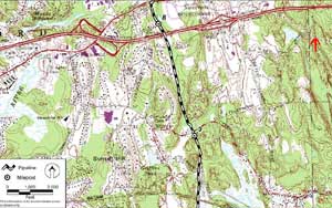
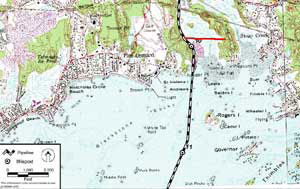
Route in Branford Page 2
Project
Overview
Route in
Branford
Supporters,
Critic's Comments
and Rebuttals
Benefits
and
Losses
Links

Contact Us
How You
Can Help
Tim's Life.Com
Main Table of Contents
 
Topo Map Two - Northern Section Topo Map Two - Southern Section
   
Islander East - Route through Branford
  • The Islander East pipeline route was carefully selected to minimize impact on the environment and private property. The Federal Energy Regulatory Commission stated " As approved, approximately 83% of the proposed pipeline either overlaps or is adjacent to existing pipeline, power line, railroad and road rights of way.".
  • At the top of topo map two, northern section pictured above, is Interstate 95 and the exit 55 interchange that connects with US 1. The dashed black and white line represents the Islander East pipeline route.
  • Rights of Way are often used for hiking trails. The red arrow in the top, right hand corner of this map points to a dashed line that is a telephone and power line right of way that will lead you into the beautiful and extensive, Guilford West Woods, trail network.
  • At the top of topo map two, southern section pictured above, are the New York to Boston railroad tracks and the Pine Orchard golf course. The dashed black and white line represents the Islander East pipeline route. Milepost 10 is located next to the trail that follows the old Branford Trolley right of way across the salt marsh to Stony Creek. Near milepost 10 the pipeline will dive deep underground to avoid disrupting the near shore shellfish beds in Long Island Sound.
Typical sights along the Branford Steam Railroad tracks
Branford Steam Railroad in action View from milepost 10
  • Rights of Way are often used for hiking trails. The solid red line near milepost 10 is now a stunningly beautiful nature trail built on the old Branford Trolley track bed. A short connecting trail leads to a open rock face high above the marsh where on a clear day you can see Long Island.
  • A trail built along the Islander East pipeline could connect the beautiful Trolley Nature trail to many points in Branford. Special consideration has been provided for the two fragile, Branford Land Trust properties that abut the pipeline. An extensive handbook titled "Construction, Restoration, and Invasive Species Control Plan for the Branford Land Trust Properties" was created by Islander East. It is available from Islander East and is in our public libraries. Perhaps it could be used as a guide for other properties along the pipeline.
  • The Islander East pipeline offers tremendous recreational opportunities that are limited only by the imagination of those involved with its progress. What benefits can you envision for our community?
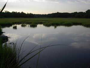
The sun sets over
a tidal pool
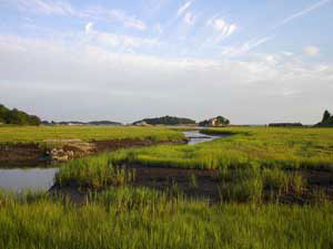
The Thimble Islands from
the Trolley Nature Trail
Tidal Pool at Sunset View from the Trolley track right of way
 
Click on the
underlined text to visit:
Branford Route - Page 1 Branford Route - Page 3